


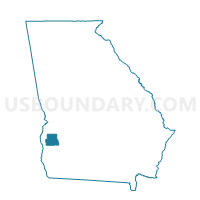
243131 - COLEMAN Voting District, Randolph County, Georgia
About
Outline

Summary
| Unique Area Identifier | 562731 |
| Name | 243131 - COLEMAN Voting District |
| County | Randolph County |
| State | Georgia |
| Area (square miles) | 56.78 |
| Land Area (square miles) | 56.74 |
| Water Area (square miles) | 0.04 |
| % of Land Area | 99.93 |
| % of Water Area | 0.07 |
| Latitude of the Internal Point | 31.68202350 |
| Longtitude of the Internal Point | -84.89659930 |
Maps


Graphs
Select a template below for downloading or customizing gragh for 243131 - COLEMAN Voting District, Randolph County, Georgia


Neighbors
Neighoring Voting District (by Name) Neighboring Voting District on the Map
- 0611 - BLUFFTON Voting District, Clay County, GA
- 0612 - ZETTO Voting District, Clay County, GA
- 0614 - OLD HEAD START Voting District, Clay County, GA
- 243718A - CUTHBERT Voting District, Randolph County, GA
- 243934 - CARNEGIE Voting District, Randolph County, GA
- 243954 - SPRINGVALE Voting District, Randolph County, GA
Top 10 Neighboring County Subdivision (by Population) Neighboring County Subdivision on the Map
- Cuthbert CCD, Randolph County, GA (5,821)
- Fort Gaines CCD, Clay County, GA (2,322)
- Bluffton CCD, Clay County, GA (861)